Followers

Showing posts with label "High Places". Show all posts

Tuesday, August 11, 2020

Trinitarian Correspondences Between Mesopotamia and the Nile


Image of Enki in the primordial Abzu


In ancient Akkadian the title Enlil refers to the High God who appoints High Kings. En means Lord or Master, and Lil refers to the wind, air, or God's breath (Ruach in Hebrew). Many ancient texts make reference to Enlil's connection to rulers. Here is an example: "Enlil, the Great Mountain, has commissioned you to gladden the hearts of lords and rulers and wish them well." (See section 38-47.)

Enlil's divine appointment of rulers is evident from Sumerian early dynastic royal inscriptions. King Zagesi (Lugalzagesi) of Umma and Uruk was said to be appointed king over all of Mesopotamia by Enlil:
"Enlil, King of all the lands, gave kingship of 'the Land' to Lugalzagesi, pointed the eyes of 'the Land' toward him, set all the lands at his feet, from sunrise to sunset." (G. Magid 2006)

Lugalzagesi conquered the Sumerian city-states and united all of them under his authority. He is believed to be the first to do so and the last emperor of Mesopotamia. Lugalzagesi was the "ishib priest of An," a title which Sargon I also took when he captured Lugalzagesi. The ishib priest is said to perfect the holy vessels used in the temple. 

Enlil appears to be one of the three divine persons in something similar to the Trinity. Belief in the Three-Person God appears to be a core belief of the Hebrew priests who served the early kingdom builders like Nimrod. These are described as "mighty men" and "heroes" in Genesis 6. They built temples and employed priests and temple servants. The Hebrew royal priests were dispersed geographically, but it seems that they promoted their unique understanding of God Father, God Son, and God Spirit wherever they lived. 

Among the Nilotic Hebrew, God Father was called Re (Father). God Son was called Horus (Most High One), and God Spirit was called Akh (Spirit). Among the Mesopotamian Hebrew, God Father was called An or Anu. God Son was called Enki (Lord Over All), and God Spirit was called Enlil (Lord wind/breath). 

That Enki is the son of God is evident from ancient texts such as this one: "Enki, the king of the Abzu, justly praises himself in his majesty: 'My father, the king of heaven and earth, made me famous in heaven and earth." (See section 61-80.)  

In the early 2nd millennium BC version of the Atrahasis Epic, Anu is described as both father and king. “Anu their father was king.” (S. Dailey. Myths from Mesopotamia: Creation, the Flood. Gilgamesh and Others; Oxford University Press. 1989, p. 9.)

Likewise, Horus was said to recognize his father in the king. "Horus is a soul and he recognizes his Father in you..." (Pyramid Texts, Utterance 423)

Even ancient terms for the royal first person are derived from the name of the High God. Examples include anaku, the royal I in Akkadian, and anochi, the royal I in ancient Egyptian.

In Canaan shrines to the Three God were dedicated to Baal Shalisha, literally the Three God, or Masters Three. One such shrine was in the hill country of Ephraim and is mentioned in 2 Kings 4:42 and 1 Samuel 9:4.


Solar Symbolism

The High God's symbol or emblem was the sun. It was a common belief in the ancient world that high kings served by the authority of the High God who shone his light (rays of the sun) upon them. This divine overshadowing is depicted on many ancient stone reliefs and tomb paintings. 


Hathor, the mother of Horus, conceived by divine overshadowing.


If this understanding of divine appointment was spread by the Hebrew ruler-priests it is misleading to speak of the High God as the "Sun God." The Hebrew distinguished between the High God and the solar symbol of the High God. They employed solar imagery such as rays of sunlight and solar crowns to speak of blessings from on high. Malachi 4:2 uses solar language in exactly this way: "But for you who fear my name, the Sun of Righteousness will rise with healing in his wings (rays)." Likewise, the Psalm 92:2 description of the Lord as “a sun and a shield” is not to be taken literally. 

Psalm 19:1-4 clearly distinguishes between the High God and the sun by asserting that God makes a tent for the sun.

The heavens declare the glory of God;
the skies proclaim the work of his hands.
Day after day they pour forth speech;
night after night they reveal knowledge.
They have no speech, they use no words;
no sound is heard from them.
Yet their measuring line goes out into all the earth,
their words to the ends of the world.
In the heavens God has pitched a tent for the sun.


Tuesday, March 26, 2019

The Religious Impulse Among Archaic Populations


6500 year shard found at elevated site in Bellinzona, Switzerland.


Alice C. Linsley

There is a common misconception that religious practices first emerged when humans became more sedentary and began to farm. The prehistoric images painted on the walls of rock shelters suggests that this is not the case. These have a religious quality and many anthropologists believe them rock shelters to be have been places of religious ritual.

There are 10,000 year temples at high elevations like Gobekli Tepe and Çatalhöyük. At Çatalhöyük the priests wore leopard skins as did the priests of the ancient Upper Nile. These archaic sites indicate organized religion with priests and rituals involving astronomy and the cycle of the seasons. In the Bible these mountain shrines and temples are called "the high places." 

7000-6000 years settlements in the Alps were contemporaneous with settlements in the Carpathian mountains and with Europe's oldest city in Bulgaria. At the same time, Galilee received immigrants from the Zagros mountains.

This is a photo of a mountain fortification in Bellinzona, Switzerland where 6500 year artifacts have been found. 


Around 70,000 years ago people living in Southern Africa carved a python out of the side of a cliff and conducted religious ceremonies there. At the back of the Botswana cave was a chamber believed to be a sacred site because there were no signs of animal bones, tools or cooking fires such as those found in South Africa's Blombos Cave of a similar age.

Another phenomena that indicates religious impulse is the 90,000+ years of burial in red ochre, a symbol of blood. This appears to express the hope of life after death. As it says in the Bible: "Life is in the blood."

From the perspective of anthropology, the deep time record of human activity is evident in the vast number of objects made and used by humans. The religious nature of ritual burial is another example of the depth of human existence. Consider these examples:

100,000 years ago - Burial of humans in red ochre at Qafzeh Cave in what is today Israel. Evidence of human habitation in the area of Bethlehem between 100,000-10,000 BC) is well-attested along the north side of Wadi Khareitun where there are three caves: Iraq al-Ahmar, Umm Qal’a, and Umm Qatafa. These caves were homes in a wooded landscape overlooking a river. At Umm Qatafa archaeologists have found the earliest evidence of the domestic use of fire in Palestine.


50,000 years ago - A small boy buried with a seashell pendant and covered in red ochre

45,000 years ago - A man buried at La Chapelle-aux-Saints in southern France in red ochre

35,000 years ago - Male buried in red ochre in Paviland Cave, Wales

32,000 years ago - Four bodies buried in red ochre at Sungir in Russia.

23,000 years ago - The "Fox Lady" of Doini Vestonice, Czechoslovakia, buried in red ochre

20,000 years ago - A thirty-year-old man buried in Bavaria surrounded by mammoth tusks and submerged in red ochre.

Australian burial sites dating to about 20,000 years reveal pink staining of the soil around the skeleton, indicating that red ochre had been sprinkled over the body. The remains of an adult male found at Lake Mungo in southeastern Australia were copiously sprinkled with red ochre.

19,000 years ago - Lady of El Mirón cave in northern Spain was buried in red ochre. She died around the age of 35.

11,000 years ago - A man and woman were buried with a dog in the area of Bonn-Oberkassel, Germany. The corpses were covered with red ochre.

7000 years ago -Two skeletons buried in red ochre found at La Braña-Arintero cave in the Cantabrian Mountains of Spain

6800 years ago - The Lake Nitchie male was buried with red ochre and was missed two front teeth (ritual removal?).

5000 years ago - Two flexed burials were found in Mehrgarh, Pakistan with a covering of red ochre on the bodies

There is no doubt that humans have had a religious impulse from the beginning. It appears to express an awareness of our mortality and a hope for life after death.


Monday, February 5, 2018

Twin Cities of the Ancient World


Tomb painting at Nekhen on the Nile.


Alice C. Linsley

Ancient royal settlements were built on major waterways on opposite sides of the river. This binary feature has been noted by scholars who refer to the paired settlements as "twin cities" (See, for example, Petr Charvat, "A Tale of Twin Cities: Archaeology and the Sumerian King Lists"). Charvat notes that the compiler(s) of the Sumerian King Lists appear to have regarded Uruk, Ur and Kish to be the three seats of legitimate royal authority in Sumer, and all three began as twin cities.

Twin cities were established along major rivers such the Nile, the Orontes, and the Tigris. The twin Nilotic cities of Nekhen and Nekheb, and the twin cities of Pe and Dep are examples. Pe and Dep merged into the city that the Greeks later called Buto.

The twin cities had shrines, temples, palaces, and treasuries. These edifices of stone were characterized by many columns or pillars. The glyph for pillar looks like the letter i capitalized. Meroe on the Orontes was known as IO and its twin on the opposite side of the river, was called AntIO (Antioch).

The cities were served by royal priests who maintained the shrines and temples and assessed taxes on cargo that moved along the waterways. To ensure that no ships passed the royal cities without paying the required tribute, the rulers built twin cities on opposite sides of the river.

Nekhen and Nekheb (Elkab) were built on opposite sides of the Nile River: Nekhen on the west side, and Nekheb on the east side. The tomb of Horemkhawef in Nekhen and the tomb of Sobeknakht in Nekheb were painted by the same artist. Hormose, the chief priest of Nekhen, requested material goods from the temple at Nekheb for use at the temple at Nekhen. The Greeks called the shrine of Nekhen "Hierakonpolis," which means "city of priests." The Greeks called Nekheb "Eleithyiaspolis," which means "city of the one who aids in childbirth."

Nekhen is called the Falcon City, as the falcon was the animal totem of Horus, the son of God Father, Re. (Re in ancient Egyptian means "father.") Votive offerings at the Nekhen temple were ten times larger than the normal mace heads and bowls found elsewhere, suggesting that this was a very prestigious shrine. Horite Hebrew priests placed invocations to Horus at the summit of the fortress as the sun rose.

Nekhen was a major city on the Nile, with an estimated population of between 15,000 and 10,000. It was a bustling city with markets, breweries and fishing. The city stretched nearly 3 miles along the edge of the Nile floodplain. At Nekhen we find evidence of an advanced civilization in the Nile Valley before the emergence of Egypt. These features include city building, written communication, hierarchical social structure, ritual burial, ship building, river trade, and complex religious expressions.

Renée Friedman, who has direct knowledge of the excavations at Nekhen, has written that the "evidence of industrial production, temples, masks, mummies, and funerary architecture as early as 3500 B.C. is placing Hierakonpolis at the forefront of traditions and practices that would come to typify Egyptian culture centuries later. These discoveries may have knocked Narmer and his palette off their historical pedestal, but they confirm the central role the city played in the long development of Egyptian civilization. It is little wonder that for millennia the deified early kings of Hierakonpolis, called the Souls of Nekhen, were honored guests at the coronations and funerals of all pharaohs."

Nekhen and Nekheb are the oldest known Horite Hebrew shrine cities, dating to about 3600 BC. The Nekhen News (p. 7) reports, "The vast majority of hair samples discovered at Nekhen were cynotrichous (Caucasian) in type as opposed to heliotrichous (Negroid)."

One of the more intriguing discoveries at Nekhen was the recovery of an almost complete beard in association with the redheaded man in Burial no. 79. The facial hair of the man in Burial no. 79 had been trimmed with a sharp blade. The presence of long wavy natural red hair and a full beard suggests that this individual may be of the same ethnicity as the red haired Ur-David mummy (1900 BC) buried in a pyramid in the Tarum Valley of China. There may also be a relationship to the red-haired Amurru (Amorites?) who lived at the northern border of Egypt's ancient empire.


Another set of twin cities in Turkey

The map above shows the location of Antioch/Hatay on the Orontes. Ancient Antioch (in Syria) was situated at the edge of a large, fertile plain between Mount Silpius and the left bank of the Orontes where it cut through to the Mediterranean. Today Mount Silpius is visible from almost any point in modern Antioch.

Antioch's location was designated Anti-Meroe. Meroe (IO) and Anti-Meroe (ant-IO) were twin cities. Meroe was an ancient Egyptian settlement on Mount Silpius. On ancient maps the location of Antioch is designated Anti-Meroe, meaning opposite Meroe.

Meroe on the Orontes was about 2800 miles from the shrine city of Meroe on the Nile. Both were under the control of the ancient sea-faring Egyptians who built sea-worthy ships. When the fortress at Meroe was build, around 4000 years ago, the north pole star was seen near Alpha Draconis in the constellation of Draco. The Orontes came to be called the Draco by some whose livelihoods depended on that river.

The Orontes was the chief river of the Levant and had sufficient depth for sail boats to come up the river from the Mediterranean.

Meroe was the farthest outpost of the Egyptian Empire and at its peak the city would have had Amurru. Amurru is the name of the northernmost district of Egypt's empire, and it included the coastal region from Ugarit to Byblos. The Orontes marked the northern boundary of Amur-ru. Meroe on the Orontes was one of the northern-most Egyptian outposts.

It is interesting that the Amurru are described as having the same physical traits as the mummified ruler buried of Nekhen (burial 79). According to the Assyriologist Archibald Sayce: "The Amorites… were a tall, handsome people, with white skins, blue eyes and reddish hair..." (The Hittites, 1889). Tomb No. 34 at Thebes, belonging to the Eighteenth Dynasty (c. 1550-c. 1292), illustrates a bearded Amorite chief with fair skin and red-brown hair.

The shrine city of Meroe was called IO. Many shrine cities were identified with the I (i) which presents a pillar. The pillar symbol is found in the names of other ancient shrine cities such as Ianna and Iunu. 

The royal city of Heliopolis on the Nile was called “Iunu” (iunu) which means "place of pillars." In the book of Genesis this city is called On. Joseph married the daughter of the priest of On. Here is the hieroglyph for the shrine city of On/iunu on the Nile:


Meroe on the Orontes was a high place about 1600 years before Antioch (Antakya, Hatay) became a Greek city in 307 BC. Antioch is probably older than 307 BC since the Greeks tended to build on earlier sites. Antioch became the more important city, with 500,000 inhabitants by the 2nd century AD. It was in Antioch that the followers of Jesus Messiah were first called "Christians."


Thursday, December 17, 2015

Karampetsos, Karambet, Karoutes


The following is an email communication which sheds light on some of the older elevated settlements in Greece. Idomeni, in Northern Greece, was one such high place which sat at the natural passage into Europe. Idomeni has recently had much media attention as an unofficial refugee settlement in which people have been living under terrible conditions. The settlement was once inhabited mainly be Bulgarian Orthodox Christians.

The background information on "The High Places" is available to read under "related reading"at the end. The oldest places of worship were at elevated sites near permanent water sources. Bible refers to these as the"high places." Burnt offerings were made at these sites so that there is a linguistic relationship between the word kar and charcoal.

Kar refers to a sheltered or fortified site with a temple of shrine tended by priests. Karnak on the Nile and Carnak in Brittany are examples. In Dravidian, car means "sheltered together" and kari refers to a river. In Manding, kara means "to assemble." Among the Nilotic Luo, kar specifies a place with boundaries. In ancient Sumerian, é-kur refers to a mountain house, a pyramid, or an elevated temple.

Since the Kar were places of burnt offerings, the term is often associated with charcoal and soot. The Turkish kara means "black." In Magyar, korom refers to soot, as does the Korean word kurim.


Mt. Giona is the fifth highest mountain in Greece.

Alice,

I read The High Places (the kar) on Academia, and I really learned a lot from it. Thank you.

My Greek grandfather's name was "Karampetsos" which I was told means "black skin"or "blackamoor" a common surname in Alexandria, Egypt. They were Orthodox priests at a village on Mount Gournia in Lidoriki, Greece from 1750 to 1948.

Now I know where the "kara" part of the name came from.

Margaret


Dear Margaret,

How interesting! Thank you for that information.

The family name Karampetsos may be related to the word Karambet which refers to a black knife introduced into Asia and the Philippines by the Kushites.

These would have been carried by warriors in service of the chief or king and by warrior-priests, suggesting that your family on the Greek side is of an ancient ruler-priest caste.

Lidoriki is built on the side of Mount Giona near the Mornos River. What is there today is likely built over much older ruins. The high elevation near a major water source fits the description of an ancient "high place" and it appears that some archaeological work is going to take place there.

Let me know what else you discover.

Best wishes,

Alice C. Linsley


Karoutes after the Nazis 

Alice,

Thank you for the archaeology link.

My grandparents' village was called Karoutes which means "The Bluffs", and it was burned to the ground on Christmas (1944?) by the Nazis. The villagers, about 800, had guns and fought, and it was the only battle Greeks won on the mainland (Crete drove them out) during WWII. My grandfather's father Efthimious was the village priest, and he was tortured in the Church before it was set on fire, as were my grandmother's brother Nick, and the village school teacher. The Nazi carried out atrocities in a number of villages through out Greece that night. It was long rumored that the Nazis were looking for two downed English flyers that the village was hiding. I can confirm that, since Nick's brother George Katsimbas was leading the Resistance, and he personally told me that was the reason in 1988.

My Great-Aunt Vasiliki's olive groves are the olive groves that visitors to the Oracle would walk through to get to the ruins.

Karoutes has new construction in the last ten years.

Margaret


Related reading: The High Places; Religion of the Archaic Rulers; Some Marks of Prehistoric Religion

Thursday, November 19, 2015

Circumcision and Standing Stones in the Judean Hills


Ritual purification and circumcision are depicted in the tomb of Ankhmahor in Saqqara,
Sixth Dynasty. Believed to be practices of a royal priest caste.

The Egyptian word for phallus was khenen related to khenty, meaning "before" or "in front of "

Tel Gezer is an old high place (kar, ophel, tamana) in the western Shephelah in Israel. It was comprised of two hills with a narrow valley between them. This represents typical typography of ancient shrine settlements with a bamah or high altar. It was a place of ritual. Likely circumcision was one of the rituals. Flint or obsidian knives were used to perform circumcisions. These often had edges sharper than modern surgical steel. Flint workshops have been found throughout the Judean hills and in Galilee. It appears that these knives were used even after the production of iron tools. Infection was less of a risk given the high saline composition of the flint.

The Egyptians had a settlement at Gezer in the 11th century BC.  In the Middle Bronze Age (ca. 2200–1500 BC) the city was fortified. There was a gate, a tower, and a protected water system. These would have been built under the direction of the ruler of the area, probably a vassal of the Pharaoh. The Judean high places were under the control of Egypt from about 2000 to 1178 BC. The tenth century BC Gezer Calendar appears to reflect Nilotic farming practices.

The Gezer water system was first excavated from 1902–1905 and 1907–1909 by Irish archaeologist R.A.S. Macalister. According to Dan Warner, Co-director of the Tel Gezer Water System Project, “The system fits well with other features in close proximity: to the south the massive gate and stone tower and to the northeast the large standing stones.”


The keyhole-shaped entrance of the water system. Photo: Dan Warner

The water system provided a means of getting water to inhabitants within the city walls. It had a “keyhole-shaped entrance,” measuring 12 feet across and 24 feet high, a sloping shaft running 138 feet downward at a 38° angle to the collection basin, and a collection basin, which extended on to a nearby cavern. Usually the excavators of water shafts and tunnels of this type took advantage of natural karstic fissures in the rock when cutting passages.

Archaic high places were on hills near water systems. They were often marked by standing stones (menhirs) such as these found at Tel Gezer. These date to the period of the standing stones erected on Salisbury Plain in England around 2500 B.C.


Standing stones at the Gezer “high place” Photo: Dennis Cole.

Circles of standing stones can be found in the Sinai, the Negev and in the Judean hills. In Hebrew they are called  masseboth (singular, massebah) which is usually translated as “pillars” or “standing stones.” They are arranged to create a religious site.

The appearance of standing stones aligns with the movements of the peoples in the R1b haplogroup.


The oldest known stone circles date to 175,000 years ago and were formed inside the Bruniquel cave in southwestern France. These appear to have been ceremonial sites where Neanderthal humans controlled fire and consumed animals.

Some of the stone circles and megaliths found in Senegal and Gambia date to the 3rd century BC. The late Catherine Acholonu called attention to megaliths in the Cross River region of Nigeria and Cameroon. She estimated a total up to 32 such sites, but did not indicate that these all were circles. Sometimes a single standing stone marked a sacred shrine. Apparently, at least one circle has been found at Emangabe.

In Sardinia, 200 menhirs in the locality Biru‘e Concas have been dated between the late Neolithic (3200-2800 BC) and the Eneolithic (2800-1800 BC). These are located at the geographic center of Sardinia.

There are about 40 Paleolithic sites in the Judean hills, many of them near Bethlehem. Human habitation in the area of Bethlehem between (100,000-10,000 BC) is well-attested along the north side of Wadi Khareitun where there are three caves: Iraq al-Ahmar, Umm Qal’a, and Umm Qatafa. These caves were homes in a wooded landscape overlooking a river. At Umm Qatafa archaeologists have found the earliest evidence of the domestic use of fire in Palestine.

Chalcolithic finds in the Judean caves include clay vessels decorated with red paint, ropes, reed mats, shell and bone necklaces, leather, wood artifacts, flint implements, and globular stone grinding and pounding vessels.


Sunday, September 6, 2015

The High Places


Artist rendering of an Iron Age oppidum
Alice C. Linsley

The iconoclastic Deuteronomist Historian makes a great fuss about the "high places" of ancient Palestine. These are represented as places of cultic debauchery and idolatry. Indeed, the high places of the archaic world - long before the time of the Deuteronomist - were fortified mounds, which in Hebrew are called "ophel" (Hebrew עֹ֫פֶל). These usually had a temple or a shrine under the supervision of a ruler and his royal priests.

For security, early human populations lived on sheltered elevated sites or fortified mounds. The root of the word ophel is OP and pertains to a complex of interrelated ideas: seeing (optic); armed guards (opiltes); walled towns (oppida), and sun shrines (O'piru) served by a caste of priests known in the ancient world as Ha'piru, Ha'biru (Hebrew) and 'Apiru. Some of the ancient fortresses were in the shape of a falcon, the totem of Horus. (The Shulba Sutras state that "he who desires heaven is to construct a fire-altar in the form of a falcon.")

Votive offerings at the high place shrines were called tama or tamata. This is related to an even more ancient word for fortified mounds: tamana. This place name (toponym) has been found in 188 countries and five continents. Over 1 million examples worldwide include Tamana-Irik, a village Gaulim in Papua New Guinea, Tamana Island in Micronesia, and the Tamana [ancient part] of the village of Palanka in Hungary.

Many Tamana antedate the high places of Susa, Körös-Tisza, the Indus Valley, Mesopotamia, Egypt, and China. The term Tamana means Stronghold in the Manding language of Africa, the Magyar language of Hungary, and the Dravidian languages spoken in India. Dr. Clyde Winters believes that the peoples who built the earliest Tamana belonged to an ancient confederation called Maa. Members of the Maa Confederation included the Magyar, ancient Egyptians, Elamites, Manding, Dravidians, and ancient Afro-Asiatic peoples. Winters believes that this explains the genetic and linguistic connections between these peoples. Dr Vámos Toth Bátor believes that these widely dispersed Tamana peoples were Proto-Saharans.

Abraham would have known the Chalcolithic high place temple at Ein-Gedi. It was constructed of stone and mud bricks and the roofing consisted of reeds. Typical of ancient sacred precincts, it was located near a permanent water source.

The Tuleilat al-Ghassul solar calendar dates to this same period and it has been suggested that it "would easily fit the world vision of a society whose life was based on a solar religion."


The phylogenetic tree of Haplogroup R1b

DNA studies confirm that the Neolithic R1b cattle-herding peoples had already dispersed across Africa, the Levant, Anatolia, and the Black Sea area by 20,000 year ago. R1b is the most common haplogroup in Western Europe, reaching over 80% of the population in Ireland, the Scottish Highlands, western Wales, the Atlantic fringe of France, the Basque country and Catalonia. It is also common in Anatolia and around the Caucasus, in parts of Russia and in Central and South Asia. Besides the Atlantic and North Sea coast of Europe, hotspots include the Po valley in north-central Italy (over 70%), Armenia (35%), the Bashkirs of the Urals region of Russia (50%), Turkmenistan (over 35%), the Hazara people of Afghanistan (35%), the Uyghurs of North-West China (20%) and the Newars of Nepal (11%). R1b-V88, a subclade specific to sub-Saharan Africa, is found in 60 to 95% of men in northern Cameroon.

The three main branches of R1b1 - R1b1a, R1b1b, R1b1c - are Middle Eastern. The southern branch, R1b1c (V88), is found mostly in the Levant and Africa. The northern branch, R1b1a (P297), seems to have originated around the Caucasus, eastern Anatolia or northern Mesopotamia. R1b1b (M335) has been found primarily in Anatolia and may be the genetic marker of the Saka.

The Hindu text Matsya Purana claims that the Saka (called “Scythians” by the Greeks) ruled the ancient world for 7000 years. Another text, Mahabharata, designates “Sakadvipa” as the “land of the Sakas” in northern India. Assyrian documents speak of the Saka presence between the Black Sea and the Caspian Sea in the time of Sargon (722-705 B.C.)


The ancient Kar

Kar is another word for a sheltered or fortified site with shrine priests. Karnak on the Nile and Carnak in Brittany are examples. In Dravidian car means "sheltered together" and kari refers to a river. In Manding kara means "to assemble." In ancient Sumerian Ekur (𒂍𒆳 É.KUR) refers to a mountain house, pyramid, or elevated temple. This same triple mountain symbol has been found on seals from the Indus Valley civilization.

Since the Kar were places of burnt offerings, the term is often associated with charcoal and soot. The Turkish kara means "black." In Magyar korom refers to soot, as does the Korean word kurim. Among the Nilotic Luo kar specifies a place with boundaries. These connections suggest that the Karakorum Mountains which bridge Pakistan and China had fortified shrines with burnt offerings.

The kars of the archaic world were mainly circular. Ki-kar refers to a circle, as in Exodus 25:11: ki-kar za-hav ta-hor, meaning "circle of pure gold." In the Anchor Bible Commentary on Genesis, E.A. Speiser recognizes that kikar refers to a circle.

Many tamana have been identified in the Carpathian mountain range. The range is called Karpaty in Czech, Polish, and Slovak, and Карпати in Ukrainian, Carpați in Romanian, Karpaten in German, Kárpátok in Hungarian, Karpati in Serbian, and Карпати in Bulgarian. In Albanian karpë means "rock."


Paleolithic Tamana

The oldest elevated settlements were near water sources. The oldest ophel in Jerusalem is near the Gihon Spring. Similar sites include Deir Tasi in Egypt; Jarmo in Iraq, and Tell Hassuna in Iraq. Of particular interest is the Paleolithic population that lived near the ravine or wadi known as Wadi-en-Natuf near Jerusalem. The Natufian population employed micro-flints, weapons, stone tools, and primitive agriculture. Artistic expressions included rock drawings and wall paintings, and they were sea travelers between 12,000 and 10,000 B.C. There are about 40 Paleolithic sites in the hills surrounding Jerusalem, many of them near Bethlehem.

Evidence of human habitation in the area of Bethlehem between 100,000-10,000 BC) is well-attested along the north side of Wadi Khareitun where there are three caves: Iraq al-Ahmar, Umm Qal’a, and Umm Qatafa. These caves were homes in a wooded landscape overlooking a river. At Umm Qatafa archaeologists have found the earliest evidence of the domestic use of fire in Palestine.


Neolithic Tamana

Surrounding Jerusalem, there are about 28 Neolithic sites that fit the same description: elevated and near water.

The top of mount Üetliberg, near Zurich, was a Neolithic fortified area with a height of 2690 feet above sea level. It was surrounded by a system of earth walls. Some 60,000 artifacts have been found here, the oldest dating to about 4000 BC.


Iron Age Oppida


Iron Age high places are even more abundant, especially in ancient Gaul. The oppida of Gaul stand on the top of steep hills. Bibracte, on the summit of Mont Beuvray, is an example. It was the capital of the Celtic Aedui and an important opiddum in Gaul. The material culture of the Aedui corresponded to the La Tène culture (800 BC- 50 BC).

A famous high place in Armenia is Erebuni Fortress, also known as Arin Berd (Armenian: Արին Բերդ; meaning the "Fortress of Blood"). It was founded in 782 BC by the Urartian King Argishti I (ruled 785–753 BC) in Yerevan, Armenia. Built on top of a hill overlooking the Arax River, it served as a military stronghold to protect the kingdom's northern borders.


Shown right: A fresco of Erebuni Fortress (8th Century BC)

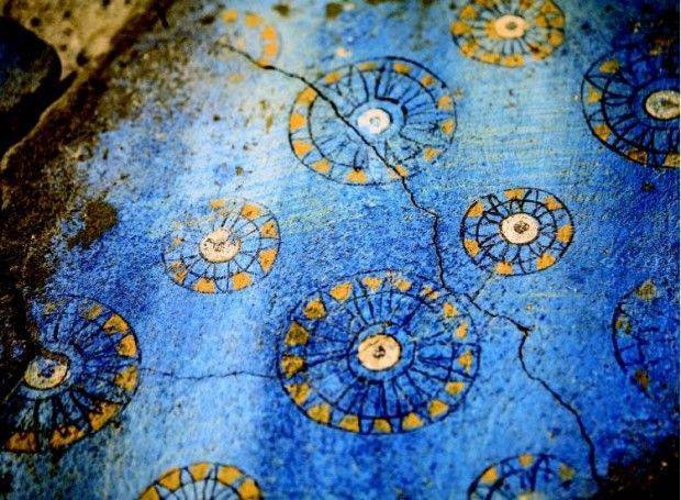
Dye used in the Erebuni frescos is composed of copper obtained from Armenian stone, which had been used in Mesopotamia since the 3rd millennium BC.


Related reading: Sanctuaries and Ancestor Worship at the Origin of the Oppida by M. Fernandez-Gotz; The Afro-Asiatic Dominion; Was Noah Mesopotamian or Proto-Saharan?; Stone Work of the Ancient World; The Relationship Between the Mande and the Japanese by Clyde Winters; A Kindling of Ancient Memory; Meroe on Orontes; Europe's Oldest Prehistoric Town Unearthed in Bulgaria; Log Cabins of Ancient European Cultures; Karampetsos, Karambet, Karoutes